Forest Society of Maine

Your land trust for Maine's North Woods.
.

  • Facebook
  • Instagram
  • Twitter
  • Home
  • About
    • Committed to Diversity
    • All About FSM
    • Mission
    • F.A.Q.s
    • Staff
    • Directors and Advisors
    • COVID19 Update for FSM
  • Conserved Lands
    • FSM Conserved Lands
    • Projects Under Way
    • Caring for Conserved Lands
    • Statement of Conservation Position
  • Forests & Climate
    • FSM Conservation and Carbon Sequestration
    • Maine Voices Op-Ed
    • Maine Won’t Wait
    • Forest Carbon Task Force
    • Maine’s Carbon Budget
    • Wood’s Role in Net Zero Carbon Buildings
  • Blog/News
    • FSM in Print
  • Jobs
    • Job Openings
    • Swan Internship
  • Contact Us
  • Support FSM
    • Ways to Give
    • Financial Statement
    • FSM’s Supporters
  • Accessibility
    • Recite Me User Guide

Gulf Hagas – Whitecap

View of Whitecap Mountain.

Acres:  10,000 acres
Year Conserved:  2016

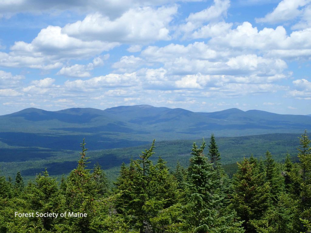
About the Property:  The Gulf Hagas – Whitecap conserved lands maintain productive forestland to help forest products businesses; provide an important buffer to 11 miles of the Appalachian Trail corridor; preserve and enhance public access to numerous campsites, hiking trails, Gulf Hagas, and a segment of the popular Interconnected Trail System for snowmobiles; and protects Eastern brook trout habitat and supports Atlantic salmon restoration.

The state of Maine owns 1,264 acres of recreational and ecological lands and holds an adjoining 7,138-acre conservation easement that ensures sustainable forestry, ecological protections, and public recreational access. Ownership of roughly 1,574 acres of ecologically important high elevation lands adjacent to the Appalachian Trail are moving to a conservation owner through a land swap.

This project and the Silver Lake – Pleasant River project were part of a combined endeavor that conserves 14,300 acres of woods, waters, and mountains.

Recreational Opportunities:  Hiking, snowshoeing, paddling, fishing, hunting, wildlife viewing, snowmobiling, ATV access, camping. The North Maine Woods manages the recreation on these lands as part of the Ki-Jo Mary Multiple Use Forest. Please visit their website for more information. Two helpful maps of the area are the KI-Jo Mary and Gulf Hagas maps found under the map tab on their website.

Gulf Hagas-Whitecap project map

Project Partners: State of Maine Department of Agriculture, Conservation, and Forestry Bureau of Public Lands.

Read the press releases in the Piscataquis Observer or the MaineBiz.

Blog Posts

  • Scammon Ridge: Conservation can help nature weather forces of change in Maine September 13, 2023
  • Hidden Benefits of Maine’s Forests May 31, 2023
  • Maine Voices: Our forests offer a valuable buffer against climate change November 2, 2022

Conserved Lands

  • Alder Stream
  • Amazon – Musquash
  • Amherst Mountains Community Forest (AMCF)
  • Attean Pond
  • Bald Ledge, Bickford Hill, and Bickford Pond
  • Big Spencer Mountain
  • Boundary Headwaters
  • Branch Lake
  • Caribou Bog
  • Chandler Hill
  • Coburn Gore
  • Corner Pond
  • Debsconeag Lakes
  • Fish River Chain of Lakes
  • Fourth Machias Lake
  • Haynes Brook
  • Grafton Forest
  • Greenwood Ponds
  • Hopkins Pond
  • Gulf Hagas – Whitecap
  • Little Big Wood Pond
  • Mattawamkeag River
  • Monson Pond
  • Moosehead Lake Shoreline
  • Moosehead Region
  • Moose River
  • Nicatous Lake
  • Nickerson Tree Farm
  • No. 5 and No. 6 Mountains
  • Reed Forest
  • Silver Lake – Pleasant River
  • Skitacook Lake
  • Tearmunn Hardwoods
  • Timberdoodle Hill
  • Violette Brook Reservoir
  • West Branch of the Penobscot River
  • York Hill

Contact Information

Main Office
115 Franklin St., 3rd Floor,
Bangor, Maine 04401
(207) 945-9200
info@fsmaine.org

Sign up for FSM's E-News

  • Email
  • Facebook
  • Instagram
  • Twitter

Copyright © 2023 Forest Society of Maine · All Rights Reserved

Built with RainStorm Foundations & WordPress