Forest Society of Maine

Your land trust for Maine's North Woods.
.

  • Facebook
  • Instagram
  • LinkedIn
  • Home
  • About
    • Committed to Diversity
    • All About FSM
    • Mission
    • F.A.Q.s
    • Staff
    • Directors and Advisors
    • Job Openings
    • Swan Internship
  • Conserved Lands
    • FSM Conserved Lands
    • Projects Under Way
    • Caring for Conserved Lands
    • Statement of Conservation Position
  • Forests & Climate
    • FSM Conservation and Carbon Sequestration
    • Partnerships to Improve Fish Passage and Climate Resilience
    • Fighting for the Forests’ Future
    • Wood’s Role in Net Zero Carbon Buildings
    • Maine Won’t Wait
    • Forest Carbon Task Force
    • Maine’s Carbon Budget
  • Wabanaki Engagement
    • FSM’s Wabanaki Engagement
    • Organizational Growth
    • Learning / Participation
    • Action
    • Resources
  • News
    • FSM in Print
  • Support FSM
    • Ways to Give
    • Financial Statement
    • FSM’s Supporters
  • Accessibility
    • Recite Me User Guide
  • Contact

FSM Featured in PAWS Trails

February 3, 2021 By Erica

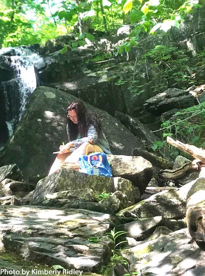
When the editor of PawsTrails Explorer magazine approached me about writing an article on the success of working forestland conservation in Maine, it was autumn 2019. The piece finally went live in December 2020. Scrolling through it, that first time, I was struck by all that has happened in the intervening months. In more ways than one, I don’t feel like the same person who wrote this.

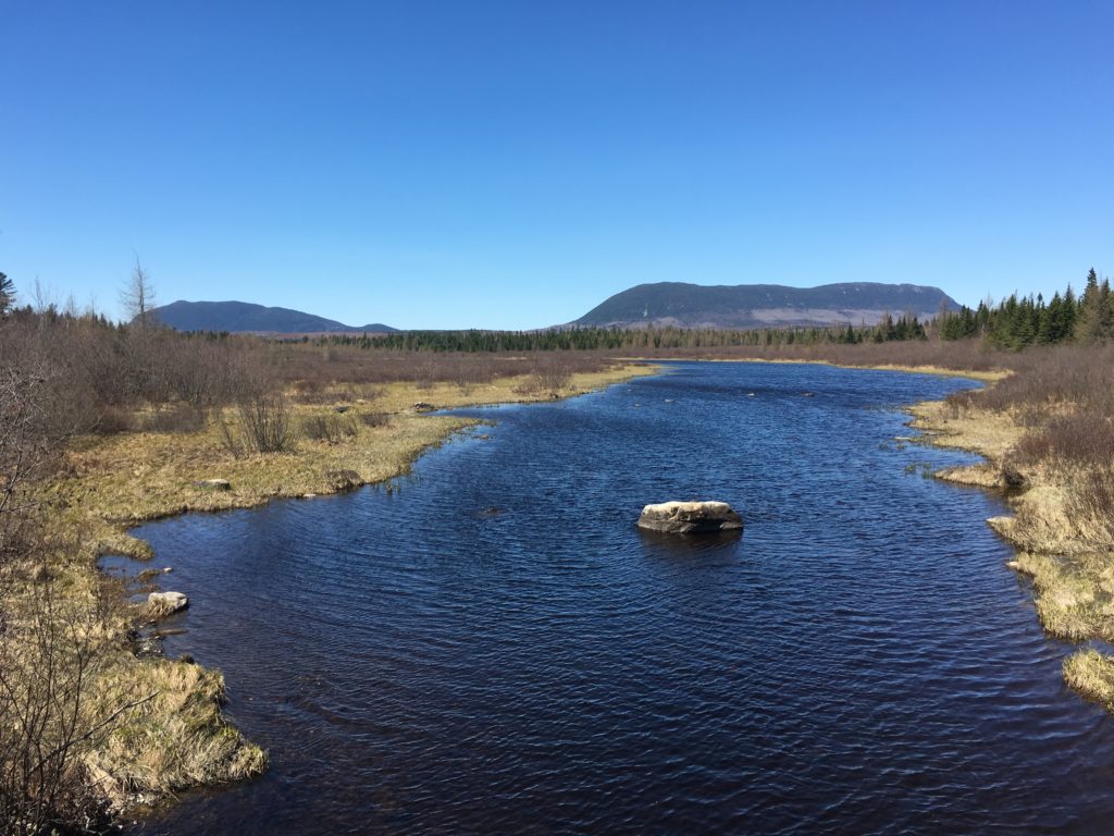
I was asked to answer a question. How did Maine, in less than three decades, manage to conserve 3,000,000 acres? The story that I told—the story that was told to me—was about consensus. It wasn’t a perfect consensus. While I was not present for the events described, I suspect that important voices were probably not heard, or even offered a seat at the table, as some of these enormous decisions about the future of Maine lands were being made. It is a tremendous understatement to say that I omitted pieces and players from a larger and more complicated narrative than I had space or time to delve into.

What has always compelled me about the Forest Society of Maine’s mission is that it acknowledges that different people can love a place for different reasons. In the article, I quote Jay Espy as saying that, “People recognized that there would need to be a land trust different from any other that had come before.” I believe that there was and is still a need for organizations like FSM, that do not see “conservation” as “land that is empty of people.”

The story of land conservation in Maine is, at its core, the story of a critical mass of individuals who took a hard, honest look into the future. They looked, and they saw with clear eyes that it was possible to lose the things they valued most. This is (some of) what happened, next:

http://www.pawstrails.com/magazine/forest-conservation-maine-us-by-erica-cassidy-dubois/

Sending warm wishes to all reading this for good health and happiness in 2021.

My very best, Erica

Filed Under: Blog, News

Want the Trail to Yourself? Try Exploring Easements

August 18, 2020 By Erica

Summer 2020 will be anything but ordinary. With some indoor activities restricted or closed, many landowners and managers across Maine are reporting a higher-than-average number of visitors to their hiking trails, parks, and preserves. Fortunately, the Moosehead Lake region has an abundance of beautiful land, waters, and trails for residents and visitors to spread out on.

The Forest Society of Maine (FSM) holds conservation easements all around Moosehead Lake, including the 359,000-acre Moosehead Region Conservation Easement (MRCE). Multiple new trails have been constructed on the MRCE since 2015, which are managed by the state of Maine. For a challenging hike with outstanding views, the new Eagle Rock Trail is an excellent alternative to the uber-popular Big Moose. At 7.4 miles (round-trip), Eagle Rock makes for a full and satisfying day, and the parking lot is never full. For a shorter day, check out the Number 4 Mountain Trail (3.4 miles round-trip), east of Moosehead Lake.

North of the lake, the Big Spencer Mountain Trail is a relatively short but steep ascent to one the region’s tallest peaks (elevation 3,230’; 4 miles round-trip). You don’t even have to get to the top to earn exceptional views: Lobster and Chesuncook lakes and Baxter State Park are visible from a small clearing just one mile from the trail head (a great picnic location). Even on a perfect summer day, it is rare to pass more than one or two other hikers on Big Spencer—perhaps because the drive is long and remote. Remember to always turn your headlights on when travelling private roads, and be sure to pull over to let logging trucks pass. Big Spencer is managed as a Maine State Ecological Reserve, and is conserved by an FSM-held easement.

All three of the above hikes, including trail maps and driving directions, can be found on MaineTrailFinder.com. The local hiking and volunteer group Moosehead Trails will also be hosting socially distant trips to Big Spencer and to the Blue Ridge Trail system in the MRCE, this summer and fall. More information can be found at Facebook.com/MooseheadTrails/.

When exploring easements, please play it safe. Emergency calls to the backcountry puts a burden on local health organizations and emergency responders. Stay within your limits, and always pack plenty of food, water, and a warm non-cotton layer, even if you are only doing a short hike. To everyone enjoying the spectacular woods and waters of the Moosehead Lake region, this summer, the Forest Society of Maine wishes you happy—and healthy—trails!


Originally published in the Piscataquis Observer (June 29, 2020) and Moosehead Matters (July 3, 2020).

Filed Under: Blog Tagged With: Moosehead Region

Fiction of the Maine Woods

January 10, 2020 By Erica

Although some very famous works of fiction may be set on the Maine coast (à la, Murder She Wrote), numerous novels and stories have also been written about and inspired by the history, communities, and remote landscape of interior Maine.

A writer sits at the base of Goodell Brook Falls.
A nature writer sits at the base of Goodell Brook Falls not far from the town of Monson, ME. Photo by Kimberly Ridley.

One such classic is Arundel, written by Pulitzer Prize-winning novelist and Maine author Kenneth Roberts. First published in 1930, Arundel is a fictionalized account of General Benedict Arnold’s arduous—and ultimately failed—campaign to wrest Québec City from the British in January 1776. Another Maine writer, Carolyn Chute, has spent decades examining poverty and small town living in books like The Beans of Egypt, Maine.

There’s just something about our state that screams “mystery,” because a huge number of books set here are crime novels, mysteries, and thrillers. Paul Doiron has received a lot of attention and awards for his series following fictional game warden, Mike Bowditch. Famed British thriller writer Lee Child even placed one of his Jack Reacher novels in Abbott.

Maine’s woods are unique in the Northeast for their vastness and opportunities for solitude, qualities that are vanishing from many of our busy lives. Quiet and solitude can be essential for enjoying a good book—and for writing one.  If you are a writer hoping to find inspiration in the Maine woods, we recommend you check out Monson Arts, a program of the Libra Foundation, which offers a paid residency program in the greater Moosehead Lake region. Readers looking for books and stories set in Maine can check out this online resource. For an index of Maine-based authors, visit the Maine State Library online.


Filed Under: Blog

Prong Pond Trail: from Flagging to (Almost!) Finished

May 23, 2019 By Erica

By Erica Cassidy Dubois
May 22, 2019

Last Saturday my husband and I woke up early to load our packs and our trusty trail dog, Arwen, into our 4-runner and head north. Outside of Greenville we met up with other volunteers from Moosehead Trails and state Bureau of Parks & Lands staff to put near-finishing touches on the new Prong Pond Trail.

The trip was exciting for me because, as a forestland steward for the Forest Society of Maine, I walked the “draft” route to Prong Pond years ago, back when it was just an idea and a trail of pink flagging hung in the branches of trees. Last summer, a professional Maine Conservation Corps crew roughed out the corridor and on Saturday volunteers cleared back winter debris and helped smooth out the footbed. It’s amazing the difference that a couple of leaf blowers, loppers, grubbing tools, and a half-dozen volunteers can make in less than a day!

The trail, once completed, will be just under one mile in length and run from the Prong Pond Road to the pond’s northeast shore. It’s a moderate hike, by Maine standards—no climbing over granite boulders, required—but it has enough elevation gain to reward hikers with an unexpected but outstanding view of Burnt Jacket, Big Moose, and Little Moose Mountains. It passes through a pleasant and relatively open forest of mature hemlock, yellow birch, and beech. The beech—like most in Maine—are suffering from the incurable and fatal Beech Bark Disease. Still, when the sun strikes last-year’s leaves, the whole golden understory glows. Sprinkled with interesting, glacial erratic boulders, the path to Prong Pond is going to be an especially great place for families to let nature-loving kids run wild and explore.

Construction of the trail came about as part of a years-long process to build or improve several non-motorized trails on the 359,000-acre Moosehead Region Conservation Easement (MRCE). The Prong Pond Trail is located on Weyerhaeuser (private) land, which the MRCE permanently conserved in 2012. The corridor is overlaid with a trail and access easement that was transferred from Weyerhaeuser to the state’s Bureau of Parks and Lands. In short: it’s complicated. But here’s the important bit. Once all the ‘i’s are dotted and the ‘t’s crossed, Weyerhaeuser will transfer small parcels on either end of the trail corridor, to the state, to be managed as a trail head parking area and a shorefront campsite, respectively. That means that, by this time next year, we’ll be able to launch canoes and kayaks from the Prong Pond boat landing, paddle over to the campsite area, and hike up the trail to the viewpoint.

Pretty sweet.

A note on wildlife: deer browse—where trees and other vegetation have been chomped back by hungry ungulates—is heavy through the trail corridor as it is located quite near to a Maine Inland Fisheries & Wildlife designated Deer Wintering Area. To minimize stress and impact on wildlife, BPL will promote the Prong Pond Trail as a three-season hike, and not a snowshoeing destination. Thanks for respecting wildlife and the good work of our state wildlife managers and biologists!View from from lookout of nearly completed Prong Pond Trail in the Moosehead Lake region.

Arwen, for her part, had a wonderful time sniffing deer trails, accepting kind words and pats from fellow volunteers, and at one point even helping to chew off a stubborn root I was attempting to clip out of the trail bed. (We’re lucky that Arwen, who has herding DNA, is more intent on keeping her pack of humans together than chasing after wildlife, otherwise Prong Pond might not be the best trail for her.) She spent the day running up and down a freshly-blazed trail, and slept a deep, satisfied sleep on the way home.


Erica Cassidy Dubois grew up in Dover-Foxcroft and works as forestland steward for the Forest Society of Maine.


Filed Under: Blog, News Tagged With: Moosehead Region

Granite peaks and golden eagles:

March 27, 2019 By Erica

Maine’s northern forests are important to the biodiversity of the world

by Erica Kaufmann, Forestland Steward

Big Spencer over Lazy Tom Bog
Big Spencer Mountain over Lazy Tom Bog

The first summer I worked as a Forest Society of Maine (FSM) steward, I took a monitoring trip up Big Spencer Mountain. It was early July; the weather was sticky and hot, and my colleague and I spent the day picking our way over rocks, ladders, and the half-brittle tree crowns that fierce winter winds had broken off and scattered along the trail.

It was mid-afternoon and we were headed home, bouncing down the Sias Hill Road when it happened:  a massive bird swooped low and crossed the road about 30 feet in front of our truck. The huge raptor hung in the air and snatched at some small animal rustling in the grass. It missed. Then it changed direction, fast, long brown flight feathers slipping through air like fingers moving through water. As it sailed off, we twisted our necks to gape back through the cloud of dust, blinking and trying to get a last look.

I’d heard people claim, before, that they’d seen a golden eagle and always assumed that they’d misidentified a juvenile Bald. But the bird I saw that day was far bigger than any adolescent bald eagle I’d ever seen, so I consulted an ornithological expert:  my boss at the time, the late Alan Hutchinson, who spent many years working with raptors. Alan assured me that it is not uncommon for golden eagles to use Maine’s remote mountains as hunting grounds.

I was recently reminded of my avian encounter while reading a 2016 paper by Janet McMahon, M.S., Diversity, Continuity, and Resilience—The Ecological Values of the Western Maine Mountains. McMahon’s paper catalogs a number of ways in which the habitats of northern and western Maine are significant on a continental and even global level.

McMahon defines the Western Maine Mountains as the “broad band from the summits of the Katahdin group… to Boundary Bald Mountain and the Mahoosuc Range on Maine’s western border,” an area that encompasses more than 5,000,000 acres. In addition to being “the only region in the eastern United States with year round activity by golden eagles, Maine’s rarest breeding bird,” the Western Maine Mountains are home to all of the state’s tallest mountains; tundra and boreal communities that occur in few places around the world, and 139 species of rare plants and animals.

Diversity, Continuity, and Resilience does an excellent job highlighting how “the timber value and resilience of [the region’s] vast forests, most of which have been in private ownership and actively managed for more than two centuries,” have been key to retaining large blocks of undeveloped, road-less land—“…the only place,” McMahon writes, “in the eastern United States where such a large area has remained continuously forested since pre-settlement times.”

Moosehead Lake, of course, is at the heart of these ecologically rich forestlands. As we take stock of the region’s many assets, we can celebrate being at the core of what the National Audubon Society has identified as our country’s largest globally important area for birds. We can boast that the woods around Nahmakanta Lake contain “the highest concentration of pristine, remote ponds in New England.”

McMahon’s paper, which includes many more facts and superlatives than I can echo in this article, is available for download at ‘mainemountaincollaborative.org/resources/.’ It’s an accessible read about some of the many gifts that Maine’s vast forests give to us residents, our visitors, and to the world.

The Forest Society of Maine is a non-profit land trust that has helped to conserve more than 1,000,000 acres of Maine’s North Woods for their ecological, economic, recreational, and cultural values. Learn more at fsmaine.org.

Originally published in Moosehead Matters, March 20, 2019


Filed Under: Blog

  • 1
  • 2
  • Next Page »

Moose Crossings & Salamander Migrations

May 1, 2025

Mark your calendars! FSM is partnering with the Bangor Public Library to host the second in a series of … [Read More...]

Blog Posts

  • Moose Crossings & Salamander Migrations May 1, 2025
  • Magalloway Lands & Waters March 18, 2025
  • Game Cameras at Nickerson Tree Farm March 7, 2025

Forest Society of Maine

209 State St, 2nd Floor
Bangor, Maine 04401
(207) 945-9200
info@fsmaine.org

Sign up for FSM's E-News

  • Email
  • Facebook
  • Instagram
  • LinkedIn

Copyright © 2025 Forest Society of Maine · All Rights Reserved

Built with RainStorm Foundations & WordPress