Through the efforts of the many project partners approximately 18,000 acres will be permanently protected.
The first part of the project has conserved more than 4,300 acres of forest surrounding Silver Lake and 12 miles of the Pleasant River.
The second part will conserve the remainder, including high elevation lands abutting Gulf Hagas and 11 miles of the Appalachian Trail.
The project is focused around the West Branch of the Pleasant River and Whitecap Mountain. Once fully completed the project will provide permanent protection for 17 miles of the West Branch of the Pleasant River, a significant wetland complex, miles of undeveloped stream and lake shore, high elevation lands including four mountain peaks bordering 11 miles of the Appalachian Trail corridor, and thousands of acres of productive forestland.
The lands provide important habitat for multiple species of birds and wildlife and significant fisheries habitat for Eastern brook trout and Atlantic salmon restoration. The project lands also provide camping, hiking, snowmobiling, fishing, hunting, and other similar recreational uses for more than 10,000 people every year. The Forest Society of Maine (FSM) has been working with two landowners, the state of Maine, other conservation groups, and local communities to conserve these lands.
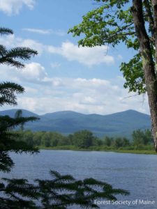
 The lands in the Gulf Hagas – Pleasant River project are important to conserve because of the unique concentration of North Woods and Appalachian Trail related recreational infrastructure and opportunities. Their permanent conservation is integral to ensuring the future of this nationally and regionally significant recreational area, which includes: the Appalachian Trail, Gulf Hagas, the Hermitage, the 100-Mile Wilderness, the Katahdin Iron Works/Jo Mary Forest, and Moosehead Lake. The project lands contain the trailhead and parking area for Gulf Hagas—a highly popular recreational destination—and they provide scenic views for people from all over the U.S. and the world who hike this portion of the Appalachian Trail each year.
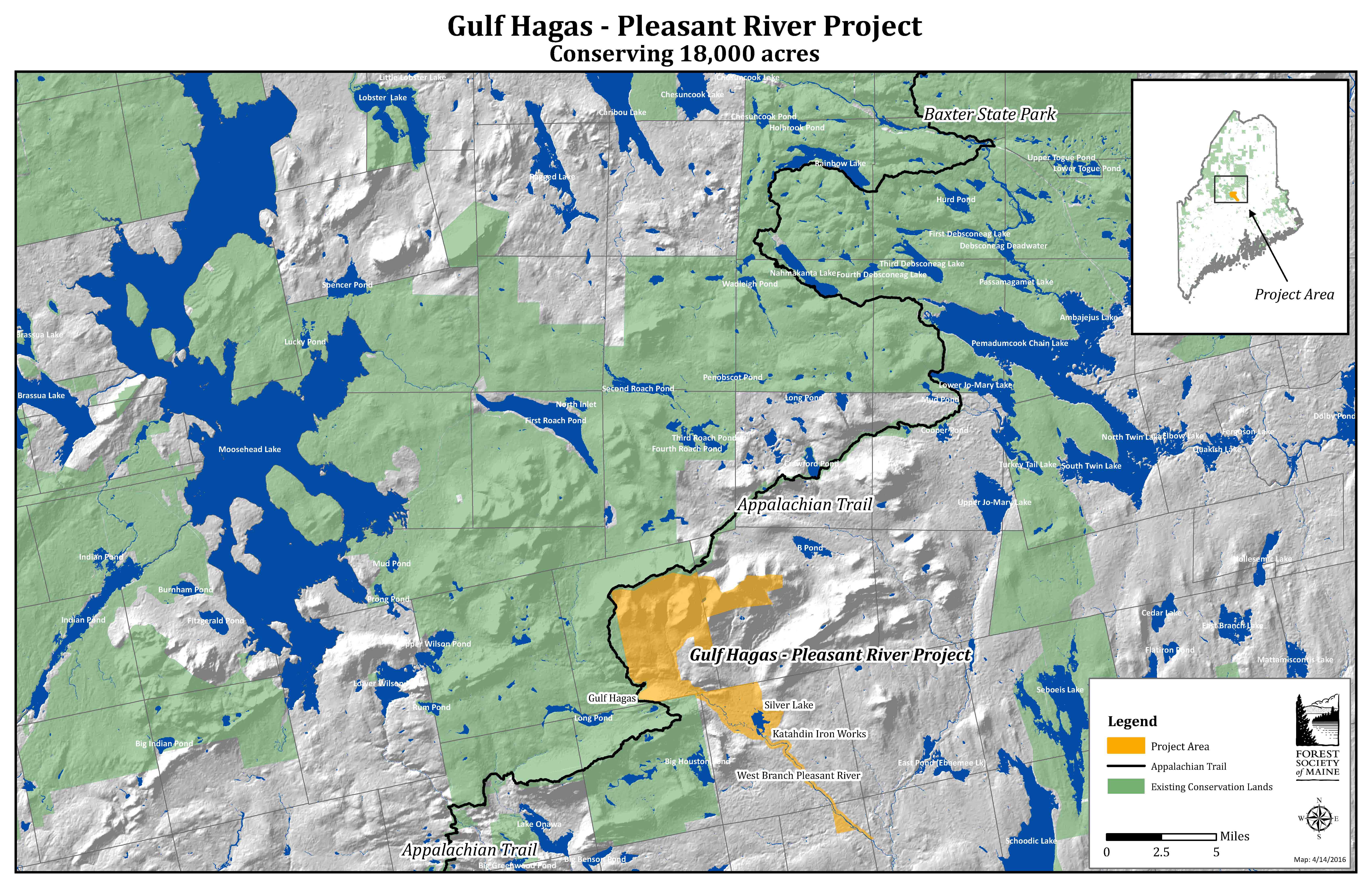 Click map to enlarge