Forest Society of Maine

Your land trust for Maine's North Woods.
.

  • Facebook
  • Instagram
  • LinkedIn
  • Home
  • About
    • Committed to Diversity
    • All About FSM
    • Mission
    • F.A.Q.’s
    • Meet our Staff
    • Directors and Advisors
    • Job Openings
    • Swan Internship
  • Conserved Lands
    • FSM Conserved Lands
    • Projects Under Way
    • Caring for Conserved Lands
    • Statement of Conservation Position
  • Forests & Climate
    • FSM Conservation and Carbon Sequestration
    • Partnerships to Improve Fish Passage and Climate Resilience
    • Fighting for the Forests’ Future
    • Wood’s Role in Net Zero Carbon Buildings
    • Maine Won’t Wait
    • Forest Carbon Task Force
    • Maine’s Carbon Budget
  • Wabanaki Engagement
    • FSM’s Wabanaki Engagement
    • Organizational Growth
    • Learning / Participation
    • How FSM is Taking Action
    • Resources & More
  • News
    • FSM in Print
    • Signup for our E-Newsletter
  • Support FSM
    • Ways To Give
    • Financial Statement
    • FSM’s Supporters
  • Accessibility
    • Recite Me Software Info & Guide
  • Contact

Archives for July 2017

From the Land Steward: Baseline Documentation Reports

July 30, 2017 By Erica

Pleasant River campsite.

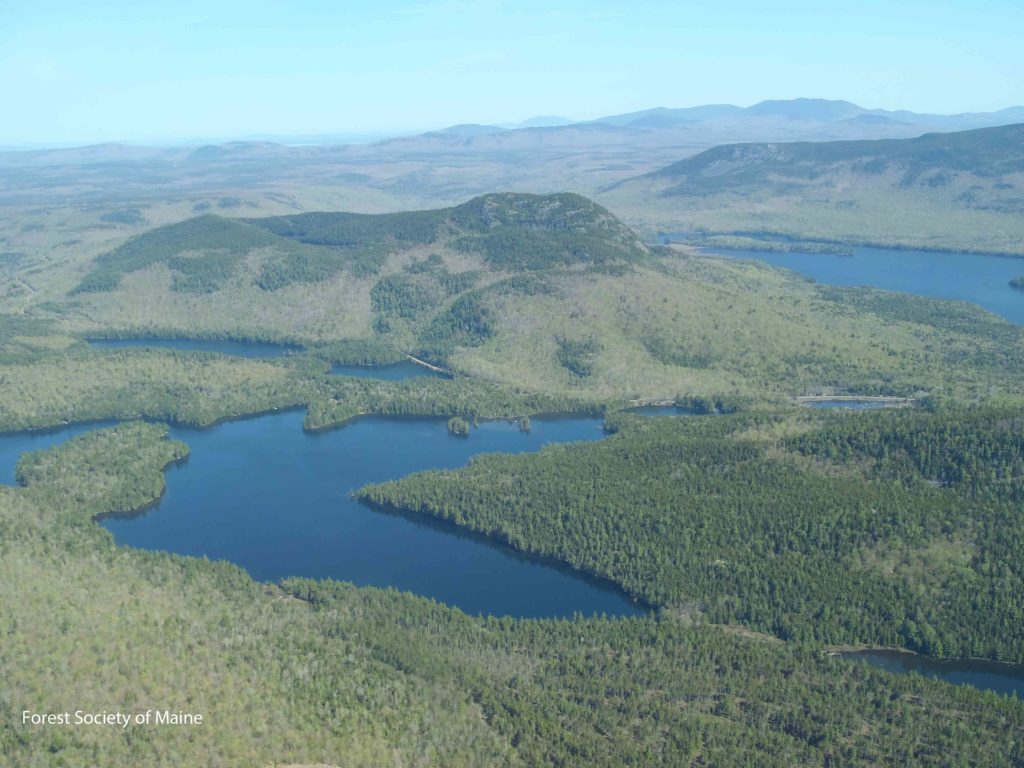
You might think that an easement steward’s work begins when a conservation project is completed, but it actually begins while the project is unfolding. For example, last fall, I spent four days walking trails; steering my way up woods roads; taking photos, notes, and GPS coordinates of important features; and occasionally picking ticks off my pants. My mission: to collect field data needed to complete the baseline documentation report for the Gulf Hagas – Pleasant River project.

If you Google ‘baseline,’ you’ll get this definition: “a minimum or starting point used for comparisons.” A baseline documentation report (BDR) for a conservation easement is just that: a starting point. It describes, in detail, the current condition of lands at the time they are conserved, through the use of maps, photos, written observations, reports, and geographic data. The landowner and FSM carefully review the BDR’s various components and agree that it accurately describes present conditions of the protected property. Both parties receive copies for future reference.

A BDR is just one of several legal documents that FSM staff and landowners review closely as conservation projects are completed. But the BDR is possibly the most important document for the successful implementation of a conservation easement, in the long-term.

19th century foundation.

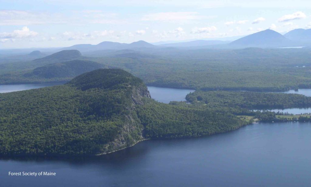
Because BDRs describe lands’ current conditions (everything from data on forest inventory to rare plant sites to recreation features and more) they help guide landowners’ management decisions and FSM’s ongoing oversight of conservation easement terms. For example, if an easement specifies how many campsites are allowed on a property, the BDR will identify the location and size of existing campsites. If the landowner closes, moves, or creates more campsites, FSM keeps track of those changes, compares that information to the BDR, and ensures that activities remain in compliance with easement terms.

BDRs can also be useful when there are conflicting conservation values. Imagine a property that has popular trails that are located very close to shorelines used by nesting loons. Disturbances or human activities during the wrong time of year on those trails might threaten the success of the loons. The BDR would note the existence of both values (the trails and the nest sites) and, together with a well-crafted conservation easement, the landowner and FSM would be able to come up with a solution to avoid a conflict of those values.

Because they document the conservation values of the properties we work to conserve, baseline documentation reports make it possible for FSM to ensure that those values are maintained (or enhanced) through time. That’s why I take to the woods prior to a project closing, to ensure that we know as much about each property as possible.


This article was originally published in Forest View, Spring 2017.

Filed Under: Blog

FSM in the News: Attean Lake Lodge

July 25, 2017 By FSM

Attean Pond and nearby mountains surrounded by more than 35,000 acres of lands FSM has helped conserve. Photo taken by FSM forestland stewards during aerial monitoring in 2016.

Check out this great Travelin’ Maine(rs) article by George and Linda Smith. The article features their visit to Attean Lake Lodge, owned by the Holden family. The lodge is in Attean Pond, a large part of which is surrounded by FSM’s very first conservation lands. The forestland was conserved in 1984 because the Colburn family wanted the land to remain forested so that it could continue to be used for forest products, enhancing the state’s economy, while also providing the opportunity for public recreational access in perpetuity. FSM is so pleased to be helping maintain the vision the Colburns had in keeping these incredible forestlands forested and available for the public to enjoy, including the many guests at Attean Lake Lodge.

Filed Under: Blog Tagged With: FSM in the News

North Maine Woods Communities are an Inviting Place to Live

July 7, 2017 By FSM

Aerial view of Little Greenwood Pond, Lake Onawa, Borestone Mountain, and Barren Mountain (traversed by the Appalachian Trail).
Aerial view of Little Greenwood Pond, Lake Onawa, Borestone Mountain, and Barren Mountain (traversed by the Appalachian Trail) not far from Monson.

I wanted to draw attention to some exciting work being done in Monson, Maine by the Libra Foundation. Recently, this work has been featured in the Boston Globe (Could Artists Revive a Fading Maine Town?), and in the Bangor Daily News and Portland Press Herald. These articles highlight Monson and the Libra Foundation’s investment in the community. The author of the Boston Globe article questions whether Monson will be viewed as a less than desirable location and too remote to attract artists to the area. As the leader of an organization that has worked in Monson and many other rural Maine communities for 20 years, I can tell you I’m convinced people will be attracted to this community, especially with this significant investment from the Libra Foundation.

Monson is surrounded by one of the most stunning landscapes in the country, and serves as a gateway to Maine’s fabled North Woods – the largest undeveloped expanse of forestland east of the Rocky Mountains. Much of this forest is privately owned and sustainably managed. Monson sits at the doorstep to this vast forest, including two million acres of permanently conserved, undeveloped woods and waters. Thanks to conservation, these lands will forever be available for recreational enjoyment and will forever be producing clean air, clean water, and dark night skies lit only by countless stars – not bright city lights. Yet Bangor, Maine’s third largest city, is only about an hour away with an airport, universities, thriving downtown, and other amenities.

Two hundred thousand people visit this region each year, and many are attracted to Moosehead Lake just 11 miles north of Monson. This region is renowned for its outdoor recreational opportunities, sitting along the Appalachian Trail as it enters the Hundred Mile Wilderness leading to Baxter State Park and Mount Katahdin. Here, there is an abundance and diversity of wildlife found nowhere else in the East. This is a region that has inspired writers and artists for well over a century, including Frederic Edwin Church, Carl Sprinchorn, and Virgil Macey Williams. Henry David Thoreau visited Monson twice on his epic journeys to Maine’s North Woods, trips that transformed his thinking and inspired his writings that have in turn inspired generations.

View of Mount Kineo and other conserved forestlands along Moosehead Lake.

But the greatest natural resource Maine has is its people. When visitors come to Maine, they’re met with warm conversations, honest, down-to-earth people, and a relaxed way of life that is a testament to those who live, work, and play here. This remains universally true whether you are in Monson, the Moosehead Lake Region, Baxter State Park, Acadia National Park, the sprawling farm fields in Aroostook County, or in Portland, our state’s largest city.

When blended with the incredible size of Maine’s North Woods, the community revitalization vision emerging from Monson with the help of the Libra Foundation, in concert with grassroots efforts underway in nearby Greenville, is unparalleled. Living in such a serene, beautiful place will surely be enticing to artists, young professionals, retirees, and others who welcome a refuge from an often busy, fast-paced world.

The Forest Society of Maine is pleased to have helped with the conservation of the expansive forestland that serves as an important resource in supporting the future of Monson and other North Woods communities. We look forward to being part of the exciting future coming about from the good work of the people of Monson and the Libra Foundation.


Filed Under: Blog

Land Trust Accreditation Notice

The land trust accreditation program recognizes land conservation organizations that meet national quality … [Read More...]

Blog Posts

  • Registered Maine Guide Talks Brook Trout
  • Request for Proposals

Forest Society of Maine

209 State St, 2nd Floor
Bangor, Maine 04401
(207) 945-9200
info@fsmaine.org

Sign up for FSM's E-News

  • Email
  • Facebook
  • Instagram
  • LinkedIn

Copyright © 2025 Forest Society of Maine · All Rights Reserved

Built with RainStorm Foundations & WordPress